top of page
Maps
 Maps for a public meeting from Charlotte Fire Department |  Cover of the mapbook for the 2012 DNC created under the Charlotte Fire Department |  Screenshot of a presentation for Census course |
|---|---|---|
 Presentation for a national conference in Washington DC, based on a project where I cataloged the textile mills (and remains of) in Cabarrus County, NC |  Presentation for SEDAAG of the textile mill project |  Web GIS example from graduate course |
 Map of Las Vegas signage |  Map of Las Vegas signage | 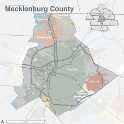 Illustrator map of Mecklenburg County for the UNC Charlotte Urban Institute |
 A map from my thesis, the percentage of public school students categorized as 'Economically Disadvantaged' who passed state tests. Shown by school district |  Site selection map for a project in grad school. The project was to choose a site for McDonalds in Mecklenburg County. |
bottom of page